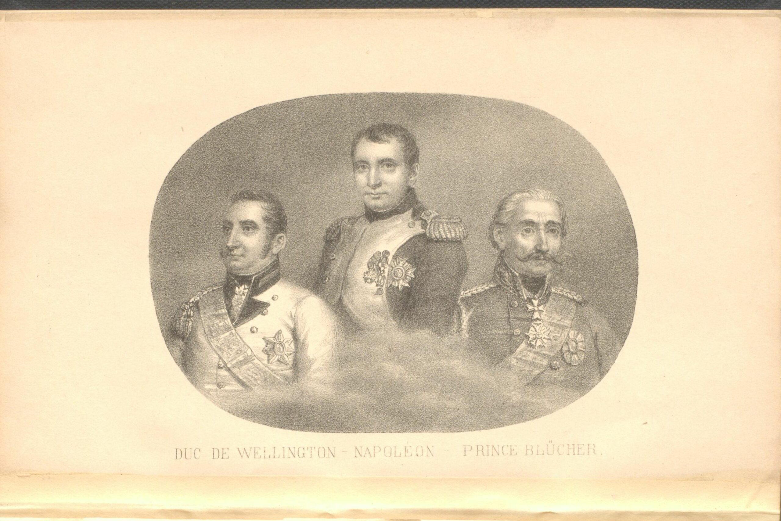
The Napoleonic Wars began in 1803 and lasted until Napoleon’s defeat at Waterloo in 1815. The Geography and Map Division holds numerous maps of the battle. I am sharing images of a few of my favorites. I would like to begin with a brief summary of Napoleon’s final battle and the events that led to …
European colonists were fascinated with the wildlife of the Western Hemisphere. They described fauna native to the Americas in memoirs, travel journals and poetry. Pictures of the unfamiliar animals were often printed on maps. In this post I will discuss four colonial era maps that were decorated with illustrations of animals. The two maps of …
William Hacke was one of the most prolific manuscript chart makers for his time. According to the Oxford Dictionary of National Biography Hacke produced over 300 navigational charts from 1682 to 1702. In this post I will briefly discuss his career and his role in the pardon of the notorious pirate Bartholomew Sharp. William Hacke was …
This post focuses on three decorative 19th century fans from the collections of the Geography and Map Division. The art of Asian fan making dates to ancient times. According to Gonglin Qian, author of Chinese Fans: Artistry and Aesthetics the earliest Chinese fan that has been found dates from 475 to 221 BC. It was …
Hy-Brasil never existed, however, it was often shown on maps as a very small island west of Ireland. The name Hy-Brasil originated from Celtic mythology. According to Irish folklore an island named Hy-Brasil was visible from the west coast of Ireland for only one day every seven years, the rest of the time it was …
Many years ago I visited an antique show held at the Washington D.C. Stadium Armory. Dealers from all over the United States displayed almost every kind of antique on tables throughout the market. One of the dealers owned an antique map store in St. Louis. I looked at many maps, dated from the 19th century …
The lunar maps shown in this post were created long before satellite images became available. The topography is highly detailed and the historical backgrounds of the astronomers who created them are compelling. The first working telescope was built in the Netherlands in 1608. British astronomer Thomas Harriot (1560-1621) made the first recorded sketches of the …
The Greek explorer and historian Megasthenes wrote that Taprobana was divided by a river and abundant in pearls and gold. Taprobana was located somewhere in the Indian Ocean and usually shown on historical maps as a large island south of India. There have been many theories about the identity of the island. Some thought Taprobana …