One of the joys involved in answering reference questions submitted to the Geography and Map Division is that some questions (the fun ones!) frequently involve extensive research in the Library’s cartographic holdings. Staff of the Geography and Map Division are also fortunate to be able to consult photocopies of maps from other institutions, early photographs …
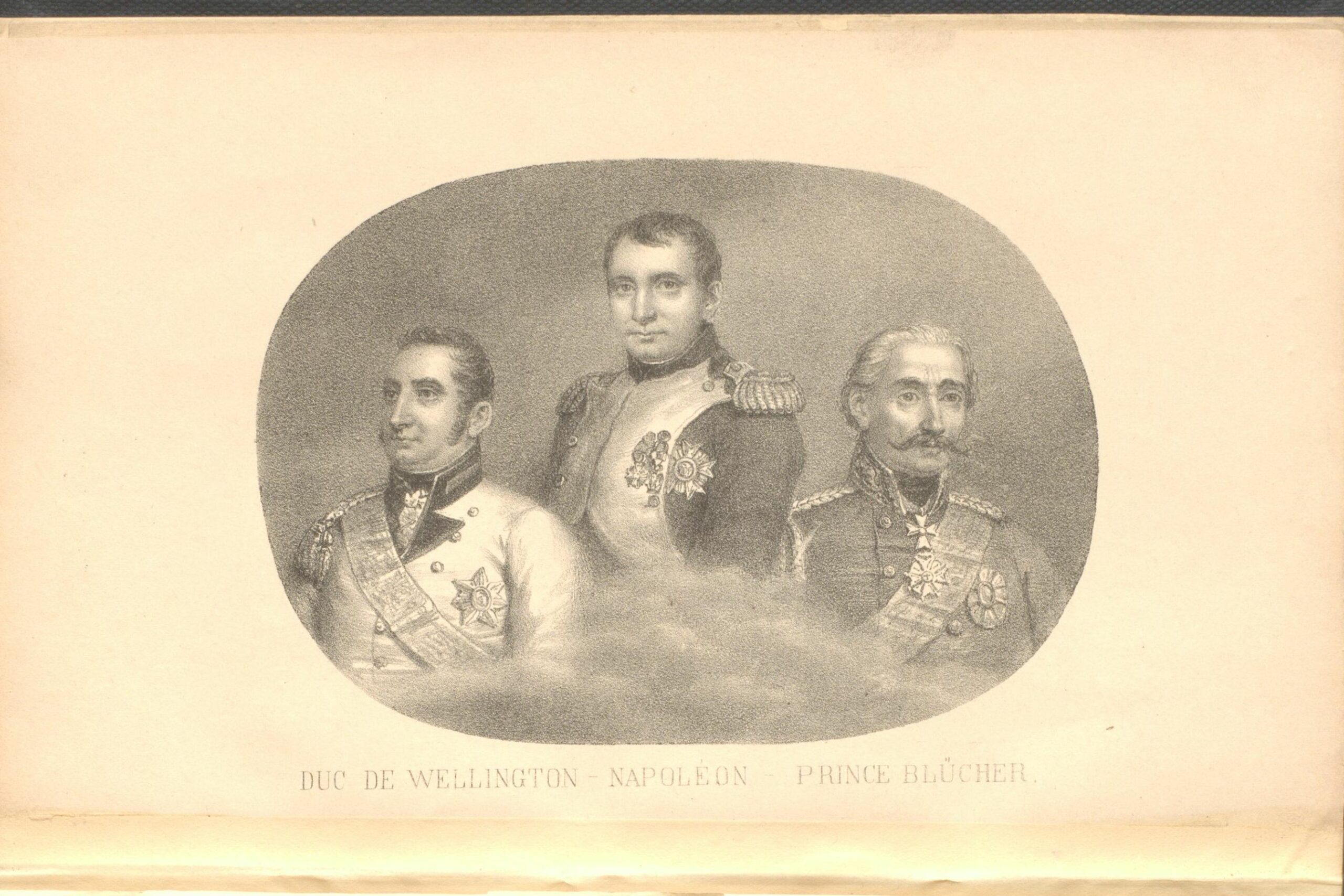
The Napoleonic Wars began in 1803 and lasted until Napoleon’s defeat at Waterloo in 1815. The Geography and Map Division holds numerous maps of the battle. I am sharing images of a few of my favorites. I would like to begin with a brief summary of Napoleon’s final battle and the events that led to …
This is a guest post by Kelly Bilz, Librarian-in-Residence in the Geography and Map Division. If you’re buying a souvenir map, would you rather it be “historical,” or “hysterical”? The Lindgren Brothers aimed for the latter in their set of maps of American landmarks. With their distinct style—a yellow background, a blue (or sometimes red) border, and …
By the 1890s the eyes of the western imperial powers were turning eastwards, especially towards Manchuria. Why had Manchuria become such a hot property? As any real estate agent will say, it’s “location, location, and location.” For Russia, its imperial gaze followed the ambitions of Tsar Nicholas II and Finance Minister Sergei Witte, who wanted …
You are invited to join the Library of Congress in celebrating GIS Day on Wednesday, November 18th from 1-4pm EST, with an afternoon of engaging talks and discussions on the theme of “Mapping the Pandemic Cases, Traces, and Mutations.” This presentation will premiere with closed captions on both the Library’s YouTube site and on the Library …
If you were asked the location of the furthest point from the center of the Earth, you would likely be inclined to state the summit of Mount Everest as an obvious choice. Looking at the 1862 pictorial map below would seem to confirm that it would be in the Himalayan Mountains of Asia. Fascinatingly, due …
This is a guest post by Kelly Bilz, Librarian-in-Residence in the Geography and Map Division. Even though Latin had fallen out of vernacular use after the fall of Rome (and began to evolve into the modern Romance languages), it lived on in its written form, becoming the lingua franca, so to speak, of scholarship. In …
European colonists were fascinated with the wildlife of the Western Hemisphere. They described fauna native to the Americas in memoirs, travel journals and poetry. Pictures of the unfamiliar animals were often printed on maps. In this post I will discuss four colonial era maps that were decorated with illustrations of animals. The two maps of …
(The title of this post is a satirical improvisation on a quote attributed to Horace Greeley, editor of the New York Tribune, when expressing his views towards the westward expansion of the United States.) Somewhere between China’s Heilongjiang Province (Manchuria) and the Russian Far East, nestled in a southern crook of Siberia’s Amur River, lies …