Andersonville Prison, arguably the most horrific Confederate prison for Union soldiers, was constructed in 1864 during the US Civil War and was located a little over a hundred miles south of Atlanta, Georgia. The prison was constructed as an open-air stockade with walls made of pine logs at least fifteen feet high. During its fourteen …
During the early 20th century, the British explorers Robert Falcon Scott and Ernest Shackleton, and the Norwegian explorer Roald Amundsen, led expeditions to the South Pole. Roald Amundsen’s polar party was the first to reach the South Pole on December 14th, 1911; five weeks later the polar party led by Robert Falcon Scott was the …
This post is part of the series Excavating Archaeology, which features selections from, and research on, the Jay I. Kislak Collection of the Archaeology & History of the Early Americas and related collections, housed in the Geography and Map Division and in the Rare Book & Special Collections Division of the Library of Congress. He …
Old maps are fantastic windows into history. If you want to know what the world was like 100, 200, or 500 years ago, you can look at a map published at that time and see where borders were located, what places were named, and what the land looked like (at least, to the degree of …
This is a guest post by Britt Long, Detailed Reference Librarian in the Geography and Map Division. Since the founding of the United States of America, our country has been in the import and export business. We have bartered and traded goods across land and sea, developing systems of transportation that are both innovative and …
This post is part of the series Excavating Archaeology, which features selections from, and research on, the Jay I. Kislak Collection of the Archaeology & History of the Early Americas and related collections, housed in the Geography and Map Division and in the Rare Book & Special Collections Division of the Library of Congress. Nature …
Though much of the history of cartography involves map-makers striving to capture the world in increasingly accurate scientific detail, sometimes the domain of the map-maker is to capture the plane of imagined, metaphorical, allegorical, or even spiritual. Such is the journey you’ll take on the “Gospel Temperance Railroad,” a 1908 map creation by George E. …
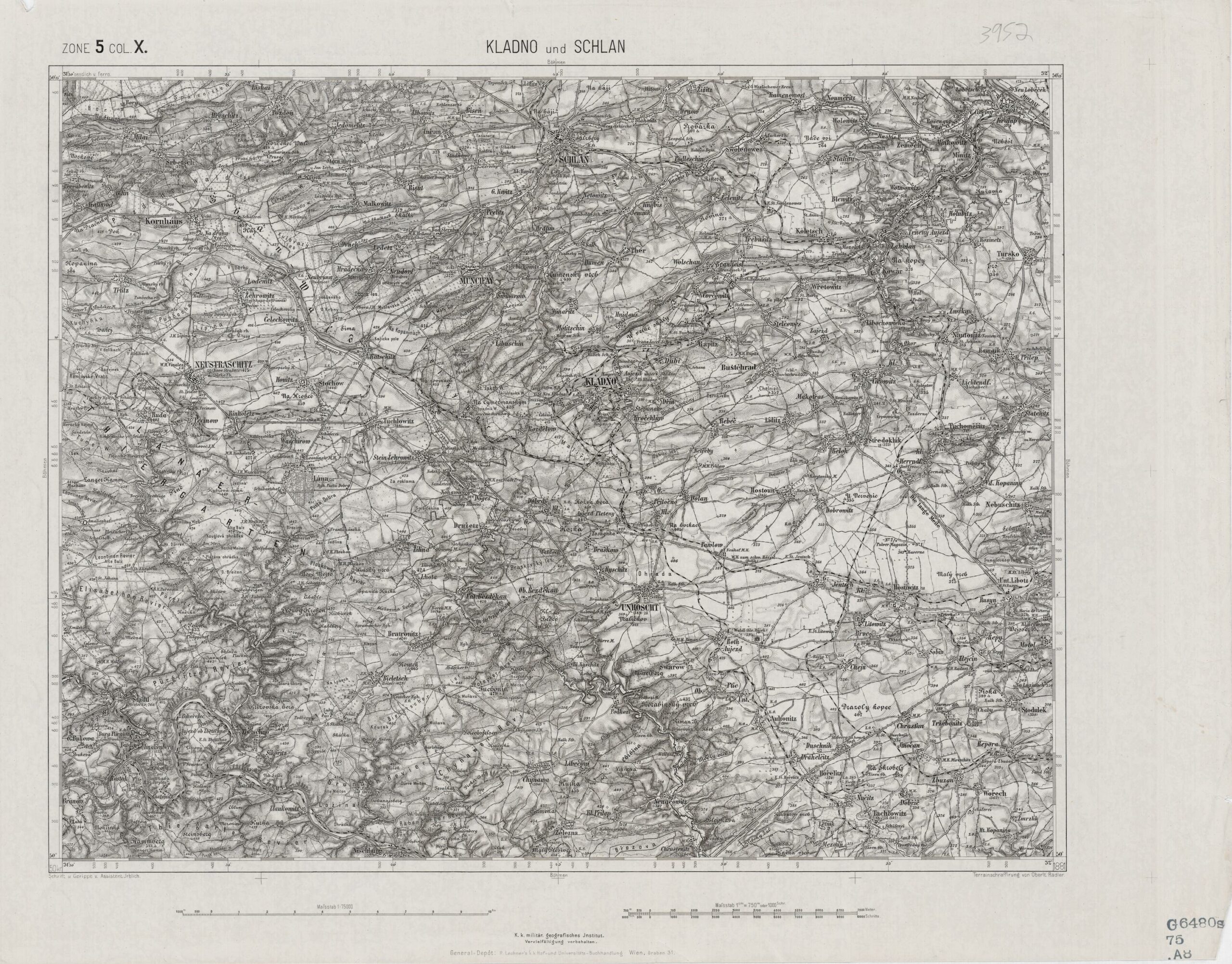
Evening settled over the Bohemian community of Lidice on June 9, 1942, probably as it had for centuries, that is, without incident. So insignificant was the village, at least from our point of view, that one could hardly distinguish it from hundreds of others in its general vicinity, if the large-scale map from the late …
This post is part of the series Excavating Archaeology, which features selections from, and research on, the Jay I. Kislak Collection of the Archaeology & History of the Early Americas and related collections, housed in the Geography and Map Division and in the Rare Book & Special Collections Division of the Library of Congress. Writing …