Women have made significant contributions to the field of cartography throughout history. In celebration of Women’s History Month I have chosen to write about the noted 19th century cartographer, educator, and historian, Eugenia Almira Wheeler Goff. Eugenia Wheeler was born in 1844 in North Clarkson, New York. Her family moved to Winona, Minnesota when she …
This blog post explores the life of notable Texas history figure, Samuel Houston, and the foundation of the city of Houston. It uses maps from our collection to showcase how Texas appeared at different points during Sam Houston's life. It also features some early maps of Houston as the city developed.
Elmer Simms Campbell’s pictorial night-club map showing Harlem’s hotspots for entertainment, dining, and drinking appeared as a centerfold in the January 18, 1933, edition of the short-lived weekly Manhattan Magazine. His work was an important contribution to Harlem’s cultural renaissance—it serves as a time capsule—the itinerary and guide of a typical Friday night at the …
Please join Geography and Map Division staff for our first virtual orientation of 2023! Date: Tuesday, February 14, 2023 Time: 3:00-4:00 pm (Eastern) Location: Zoom Register for this session here! Reference librarians Amelia Raines and Julie Stoner will present an introduction to the Library of Congress Geography and Map collections. This general orientation session will highlight a …
In 1884-85, a group of European dignitaries met in Berlin and delineated the boundaries of French, British, Belgian, Portuguese, Italian, Spanish, and German colonies on the continent of Africa. Lines drawn on the map became administrative reality, and over the next few decades European governments busied themselves with exploring, surveying, and conquering their new territories. One …
This is a guest post by Rachel Trent, Digital Collections and Automation Coordinator in the Geography and Map Division. Every time you look at an online image of a historical map, what you’re viewing is really just a spreadsheet of numbers. Or more likely, three spreadsheets, one each for red, green, and blue (the technical way to …
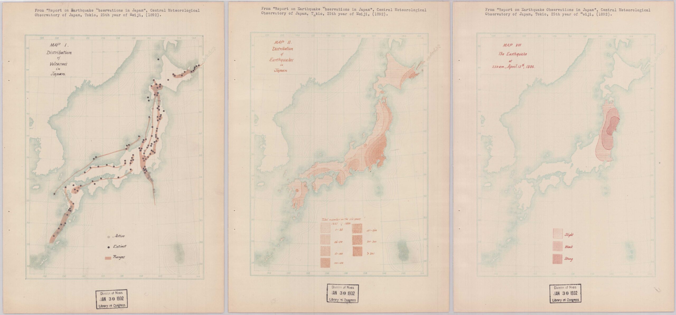
Did you know that worldwide, roughly 55 earthquakes are recorded per day? Of course, the vast majority of these seismic events are minor, making it all the more impressive that we are able to detect them. The technology used to gather data on earthquakes and seismic movements has vastly improved over time, and with it …
On October 27, 2022, the Library of Congress held an event for members of the Philip Lee Phillips Society, the Washington Map Society, and the Friends of the Library of Congress. The event was named “Explore the Depths of the Geography and Map Division.” Unusual maps and atlases from the collections of the Geography …